Category: Team Projects
Digitally Fabricated Hands
Project Name- Hands
Team Members- Gin
Project Overview- To create digitally fabricated hands for NJSM. The hands should accurately display the holding of various museum objects and should also make use of our digital fabrication tools to make them more professional quality and faster.
Project Vision Document- https://docs.google.com/document/d/125raeGh_wNwDsFznKBmUE3aWSCtZAKU-nAEJWve5WGw/edit#
Final Presentation https://docs.google.com/presentation/d/1p3b_mUw9Ul6lJHs6x5doJECmM5v5dfE6znmybhvPlmA/edit#slide=id.gc6f75fceb_0_0
Virtual State Museum
Team Members:
Christian Czmar
Project Overview:
An interactive virtual recreation of the New Jersey’s Original People exhibit created in Unity. People will be able to go online to see explore the exhibit and see the displays and information available there.
Presentation: Here
Behind The Pen: Listening In On Historic Documents
Project Overview
In the narrow hallway of the museum, specific treaties or contracts put together by the settlers and/or Native Americans can have audio files tied to them – namely, what one side and/or the other was saying and thinking as they put it together. Having the opportunity to get a sense of both sides’ subtext and true motives, beyond the fluff on the paper, will creatively and deeply engage guests in the politics and stakes of the era.
Team Members
Vincent Giacalone
Israel Dominguez (voice work)
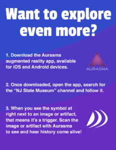
Aurasma Guide For Museum Guests
Research
Interactive Story Experience
The Team
Nick Parr – Twine Development
Malakye Otey – Front End Development
Project Overview
We intend to create an interactive experience where users will be able to go through the story leading up to the creation of a particular object in one of the museum exhibits. By creating a front end for these stories, we hope to extend this experience into a hub that can hold more experiences and be expanded at will.
Project Vision Document
Research
Projectile Point Information: http://www.projectilepoints.net/
Projectile Locations:
Tools Used:
HTML/CSS/JS
Progress
We have set up a mock up using twine (note it is far from finished)
Final Presentation
Website: https://parrn1.github.io/
Presentation: here
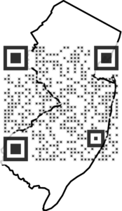
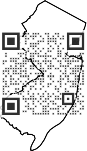
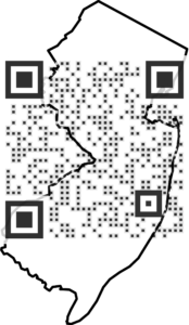
Origin of Object Map
- Project Overview:
My project is a mobile platform that will use QR codes to show the location of specific objects in the collection on a GPS map like google maps in order for patrons to get a better understanding of where exactly these objects originated from and have them represented visually.
- Team Members:
I will be working on this project on my own.
- Vision Document:
- Research:
- Final Presentation:

PowerPoint Presentation: https://docs.google.com/presentation/d/1NcuY2v8somUU7unJWprlXqe_8js_W2rOhyO-csJUnYI/edit?usp=sharing
Link to web pages: https://ngarlatti95.github.io/maps/map1
https://ngarlatti95.github.io/maps/map2
https://ngarlatti95.github.io/maps/map3
https://ngarlatti95.github.io/maps/map4
The Journey of Objects
Israel Dominguez
IMM 470-01 Fall 2016
Project Overview
For my project I plan to provided more information and history of an object. I hope to explain how objects were made back in the day and potentially discuss where it has been and how it eventually was brought into the NJ State Museum. The problem i’m focusing on to to help place more information about the object without taking up to much space. With the help of Aurasma visitors will be able to use their own phone to scan a piece of image or object on display and then they will be directed towards a visual,video,audio or text explaining the background of an object
Team Members
Israel Dominguez
Vincent Giacalone- voice work
Vision Statement
Final Presentation
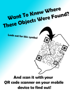
Poster for Visitors
Symbol

Research
http://pidba.utk.edu/maps.htm
http://www.texasbeyondhistory.net/gault/clovis.html
1/other-tool-types-morphology-function-gc76/110054-re-purposed-clovis-points
NJ Trade Routes Interactive Map
NJ Trade Routes Interactive Map
Team Members:
Dustin Guillemin – Backend Developer
Mike Martin – Content and User Interface
Project Overview:
We are looking to create an interactive map that shows the trade between the Native Americans and Europeans in NJ. We will be highlighting certain objects in the museum and showing off where they originated from.
Vision Document:
https://docs.google.com/document/d/100i7aItb1YtXm3j9iJQ_pIY-QP8wws-SHO-Lf3MKstA/edit?usp=sharing
Research & Progress:
https://drive.google.com/drive/folders/0Bw6eBx0Op5vVNDdlSVlkWkJHY28?usp=sharing
Final Presentation:
https://docs.google.com/presentation/d/1F1oFXUMBahoJB_fQpYZ4126XYjLwLy4nbkyxK6kJC6s/edit?usp=sharing